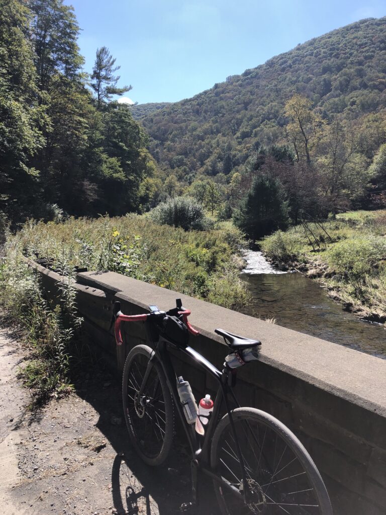
As indicated in our series of posts on the Public Lands Ride – 2020 and the in-person Public Lands Ride – 2021, the event originally started in 2019 as an annual mixed-surface gathering hosted by the Pennsylvania Environmental Council. In response to the COVID-19 pandemic in 2020, PEC quickly pivoted to a virtual format, releasing several routes in various state parks and forests in western and central PA. Fortunately, PEC was able to host the in-person event in 2021. As an added bonus, a few more virtual routes were released as well. One of those routes was the Public Lands Ride – 2021: Elk State Forest.

The Hub’s Quick Take on the Public Lands Ride – 2021: Elk State Forest
We rode this route on the Friday before the in-person Public Land Ride referenced above. It is about an hour and a half drive north of Black Moshannon State Park where the in-person event takes place. A perfect weekend of camping and riding bikes!
If one word captures the essence of this route, it is vistas! There are so many that you may just get tired of stopping for pictures! This route is a can’t miss. Clocking in at right around 55 miles and 5,000 feet of climbing, you are treated to beautiful overlooks, fairly well-maintained terrain, and just the right amount of remoteness. Although we didn’t catch sight of an elk, we saw our fair share of wildlife, including a few bears (luckily the hind ends), an elusive cat of the sort we couldn’t discern it was so quick, turkeys, deer, and the like.
There are four distinct roads/sections that make this route amazing (in addition to the vistas): Cowley Hill/Ridge Road climb, Brooks Run Road climb, Ridge Road “proper,” and the Crooked Run Road descent. That is not to diminish the rest of the route, these just stand out.
Cowley Hill/Ridge Road Climb
Cowley Hill starts at the beginning of the route from Sizerville State Park. We got out mid-morning and Cowley Hill was shielded from the sun by the lush forest. The climb was gradual and an idyllic start to a wonderful day. Cowley Hill turns onto Ridge Road at about mile 5.5. Ridge Road is common to several sections of the route and acts as a connector to the two loops encompassing the ride. Your first encounter with Ridge Road here will be a one mile continuation of Cowley Hill. It will then turn into rollers for about 5 miles. You also get a taste of the vistas on Ridge with a nice view of Salt Run at about mile 12.
Brooks Run Road Climb
The Brooks Run Road climb comes at about mile 28, just after exiting Sinnemahoning State Park. We hit the climb midday, but the lush forest canopy over Brooks Run masked the sun. The babbling stream, shade, and rugged landscape are quintessential forest features. The kind that make you say, man this is why I love this type of riding!
Ridge Road “Proper”
At the top of Brooks Run at about mile 33, you hit the section and road that defines this route – Ridge Road “proper” as we call it. This section of rolling terrain is atop beauty to the left and right as far as the eye can see. Squaretimber Vista, Norcross Vista, Whitehead Vista, and Logue Run Vista. There was no better place to be on that early October afternoon. We think you’ll agree no matter when you are there! The rollers and Ridge Road vistas ended at about mile 38. You got that right, 5 miles of vista rubbernecking!
Crooked Run Road Descent
But, fear not. There was one final vista, Crooked Run that welcomes you to an exhilarating 5ish mile screamer of a descent back to Sizerville. The first few miles have a couple of awesome switchbacks, and the remainder was winding bliss! Nothing too terribly steep. One where you can just keep your fingers off the brake levers and enjoy the wind at your face.
Obviously we think that this route is certainly not one to miss. Check out some of our pics below of the representative terrain. As always, we recommend you read PEC’s blog post containing the details of the route. It also includes great information on nearby attractions, resources, history, etc.
Terrain by Pictures of the Public Lands Ride – 2021: Elk State Forest
Public Lands Ride – 2021: Elk State Forest
NOTE: This version of the routes takes Park Drive through Sinnemahoning State Park. You also have the option of taking the Low Lands Trail in the park instead. Keep an eye out for a left turn into the wildlife viewing area parking lot about .4 of a mile prior to the turn onto Park Drive. The LLT trailhead is at the back left of the wildlife viewing area parking lot.
We recently rode the Public Lands Ride – 2021: Worlds End State Park/Loyalsock State Forest route. Check out our key takeaways and highlights of that ride in our route report. Also, make sure you keep up-to-date on all The Hub’s content by following us on social media (links on the top and bottom of this page), and by entering your info into the Newsletter signup (to the right and bottom).


